Annika Oberdorf
- History and transformation of the Turia River
Founded over two millennia ago on the river’s banks, Valencia evolved closely linked with the Turia. Providing water for domestic use, livestock and irrigation, the river shaped the city’s morphology [1]. The fertile floodplains supported agricultural prosperity and urban expansion, while at the same time posing a persistent flood threat to Valencia. The river exposed the city to cyclically repeated catastrophic floods with major events already recorded in 1517, 1731 and 1776 [2]. These extreme weather events resulted from the Mediterranean climate when intense rainstorms and limited channel capacity resulted in rapid and devastating flash floods causing material damage and deaths. The severity of the disaster was amplified by reduced soil infiltration capacity due to the increased sealing of surfaces because of urban growth [3]. Despite efforts to mitigate these risks, financial constraints, political instability and administrative fragmentation prevented effective interventions [1].
The October 1957 flood, provoked by the gota fría, marked a decisive turning point when up to 300 l/m² fell in a few hours. As the Turia overtopped its banks, more than 80 people died and the historic center and critical infrastructure were severely damaged [2]. In response, in 1958 authorities developed the Plan Sur, a hydraulic and urban project to divert the Turia into a newly excavated 12 km long and 200 m wide channel south of the city with a capacity of 5.000 m³/s to prevent the urban core from flood risks [1,2]. Upon completion of the project in 1972, initial plans intended to convert the former riverbed into a highway. Following public opposition, it was instead transformed in the 1980s into a 110 hectare urban park, the Jardín del Turia [1].
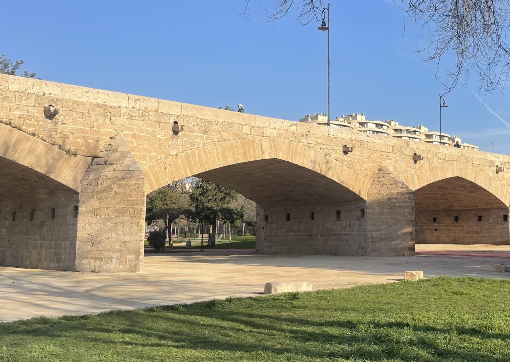
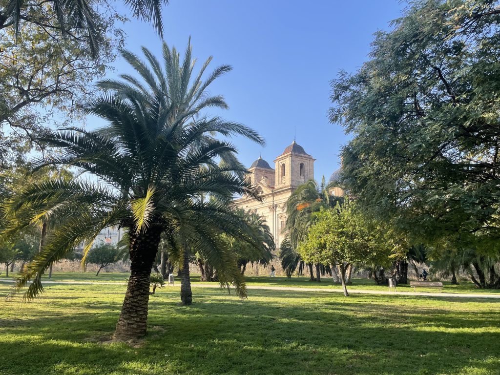
Fig. Jardín del Turia (source: author)
- Impact assessment of the Turia Park and the diverted river
- Effects in the city center
The creation of the Turia Park as a green space in Valencia’s center represented a shift from reactive flood defense to integrated sustainable urban planning [1,3]. Today, the park hosts facilities such as the City of Arts and Sciences and the Palau de la Música and has become the city’s green spine [2].
Through these attractions, the park generated economic benefits by attracting tourism, hospitality and cultural industries. This growth reinforced Valencia’s international image, created employment and generated economic inflows [2]. From an ecological perspective, it provides urban cooling, improves air quality and offers ecosystem services. Estimates for the nearby Turia Natural Park range between 163 million and 482 million euros, which highlights the importance of climate regulation and biodiversity [4]. Socially, the park functions as an everyday public space which enhances social connectivity, supports sports and leisure, strengthens a shared urban identity and improves quality of life [1,2]. Nevertheless, large roads along its edges limit its integration with surrounding neighborhoods [1].
- Redistribution of risks on the province of Valencia
Diverting the Turia river removed the flood threat from the city center of Valencia. However, this human intervention could not entirely eliminate the flood hazard. Instead, it redistributed the risks spatially across the province of Valencia. While the city center is now largely protected from extreme rainfall events, the southern areas of the province along the new river route, such as Pinedo and El Saler, have become exposed to flash floods [2].
Moreover, the implementation of the Plan Sur changed the river’s hydro-geomorphological characteristics. The channel was constructed as an engineered corridor, which weakened the ecological functioning of the river and therefore reduced its natural buffering capacity. These challenges are further reinforced by increased water flow velocities and erosion resulting from sediment extraction [3]. In addition, soil sealing due to urbanization and infrastructure development has lead to a lack of infiltration capacity in the floodplains surrounding the diverted Turia river. As a result, the channelization poses threats to the southern area of the province [2].
- Climate Resilience and the 2024 DANA flood
The 2024 DANA flood illustrates the vulnerability of the southern municipalities of the province to extreme rainfall events. According to the World Meteorological Organization, rainfalls exceeding 300 l/m² were recorded. In Chiva, 491 l/m² of precipitation fell during eight hours, corresponding to the region’s mean annual rainfall [5]. The catastrophic flooding claimed over 200 lives, affected 87 municipalities and generated economic losses of 479.6 million euros [2]. By rising over two meters, the floodwaters inundated homes, cellars and garages. The regions experiencing the highest flood impact were not those adjacent to the ravine, but rather zones with limited open space, varied terrain and street layouts facilitating water accumulation. Most fatalities occurred when people were trapped inside their homes or on streets [6]. Although the Plan Sur protected the city center, southern municipalities still experienced catastrophic flooding. From a resilience perspective, this highlights that the risk had been shifted rather than eliminated [2].
The DANA flood was caused by the gota frìa [2]. Warm, moist air met cold polar air aloft, which formed a persistent low-pressure system that triggered intense storms and flash floods. Climate change intensifies the risk of such extreme events [5]. This underlines the urgent need to strengthen flood resilience across the province.
- Strategies to enhance Valencia’s flood resilience
Expanding Blue-Green Infrastructures is an effective approach to address the vulnerability of southern municipalities in the province and mitigate flood risks. In the Jardín del Turia, this could involve floodable zones, wetlands and storage basins to retain water while preserving recreational functions, inspired by Amsterdam and Copenhagen [2]. This concept also provides ecological benefits regarding thermal regulation and biodiversity [7]. Resilience strategies for the south should combine nature-based solutions with conventional flood protection [3], which limit urbanization in exposed areas, restore floodplains and implement drainage and retention systems [2], especially in densely populated areas. Nevertheless, success also depends on governance, community engagement and alignment with global frameworks like the SDGs [3]. By implementing resilience strategies, Valencia can enhance the safety of its population and economy and serve as a model for other Mediterranean cities facing similar challenges.
- References
[1] Portugués Mollà, I. (2024). Management of the Turia River in Valencia (Spain): The Recent History of an Unfinished Metamorphosis. In J. Farguell Pérez & A. Santasusagna Riu (Eds.), Urban and Metropolitan Rivers – Geomorphology, Planning and Perception (1st ed., pp. 155-171). Springer Nature Switzerland AG.
[2] Polo-Martín, B. (2025). Valencia´s battle against floods: A cartographic review to assess water management strategies. Journal of Geography and Cartography, 8(1), 10129. https://doi.org/10.24294/jgc10129
[3] Cortiços, N.D. & Duarte, C.C. (2025). Climate Resilience and Adaptive Strategies for Flood Mitigation: The Valencia Paradigm. Sustainability, 17, 4980. https://doi.org/10.3390/ su17114980
[4] Estruch-Guitart, V. & Valls-Civera, A. (2018). An economic valuation of ecosystem services provided by the River Turia Natural Park (Valencia). Economía Agraria y Recursos Naturales, 18(2), 93-115. https:// doi.org/10.7201/earn.2018.02.05
[5] World Meteorological Organization (WMO). (2024, October 31). Devastating rainfall hits Spain in yet another flood-related disaster. https://wmo.int/media/news/devastating-rainfall-hits-spain-yet-another-flood-related-disaster. (Accessed on March 7, 2026)
[6] Del Romero Renau, L., Melo Escrihuela, C. & Salvador Fernández, N. (2025). Spatial planning, flood risk and adaptation to climate change after the October 2024 flash flood in Vlanecia, Spain: Towards a multi-level governance strategy. Cuadernos de Geografía. 114-115, 457-480. https://doi.org/10.7203/CGUV.114-15.32055
[7] Polo-Martín, B. (2025). The Potential of Blue-Green Infrastructures (BGI’s) to Boost Urban Resilience: Examples from Spain. Urban Sci., 9, 102. https:// doi.org/10.3390/urbansci9040102