Our projects
EELISA GREEN PLANET
Re-inventing the “European engineer”.
UPM-FEGA
Abandoned agricultural lands.
UPM-QUASAR
Copernicus for forescasting rainfed crops.
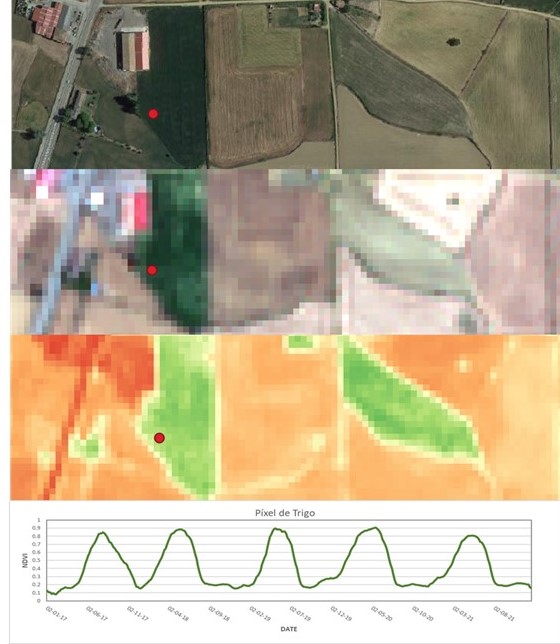
SATCHANGE
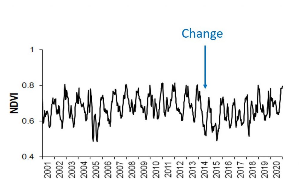
Mapping Land Use Change.
INFOLANDYN
An information system to assess Global Ecosystem Dynamics.
Previous projects
| Project | Funding |
|---|---|
| Operational monitoring and Forecasting system for Resilience of agriculture and forestry under intensification of the water cycle: a Big Data approach”. | TSK ELECTRÓNICA y ELECTRICIDAD SA |
| Dynamic mapping of bare soil and crop residues in Mediterranean agricultural regions using remote sensing time series. | Research National Plan |
| Management of residues and evaluation of two types of sowing machines in conservation tillage systems: crop development and evolution of weeds. | CICYT (AGL 2007-65698-C03- 01) |
| Methodology for integrating remote sensing information for the prevention of forest fires through statistical prediction. | Fundación MAPFRE |
| Prediction of reference Evapotranspiration in stations of the SIAR network in Spain by means of Statistical Analysis of time series. | TragsaTec. |
| Technical assistance “Evaluation of the wind and hail series for the Iberian Peninsula”. | EG REinsurance AG España |
| Technical assistance “Considerations on the nature explosive cyclogenesis of extra-tropical cyclone Klaus that occurred during January 2009. | Rinsurer KRG- AG |
| Consulting and technical assistance for the implementation in the environmental sector of new technologies and advanced methodologies with hyperspectral sensors. | EGMASA (A. de Medioambiente de Andalucía) |
| Technical assistance “Data analysis support for the Hyperval project. Processing and analysis of hyperspectral information generated by airborne sensors, AHS and CASI on board airplanes and acquired by the INTA”. | INTA |