
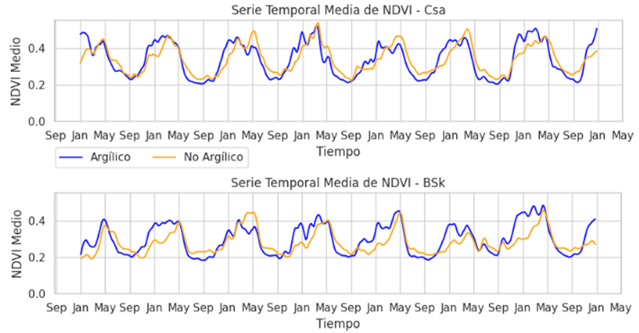
Assessment of the Quality of Rainfed Agricultural Soils in Spanish Mediterranean Areas through the Application of Big Data and Remote Sensing Techniques.
Author: Mario Salvador López Muñoz
Supervisors: Víctor Cicuéndez López-Ocaña
2025. Master’s thesis.

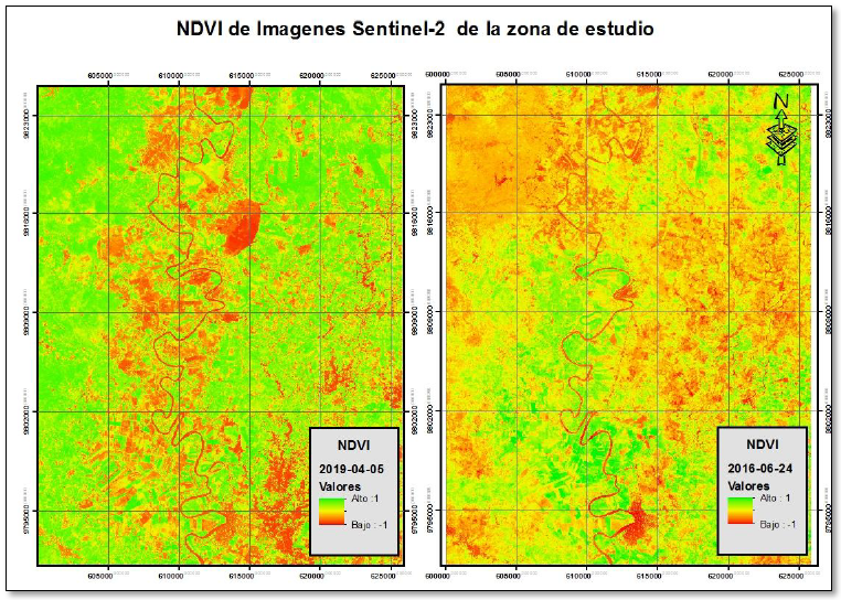
Analysis of the severity and resilience of the Serradilla del Arroyo fire using remote sensing (S2 AND MODIS).
Author: Tomás Luis Pugni Stanek.
Supervisors: Joaquín Solana Gutiérrez.
2024. Master’s thesis.

Comparative study of two hydrological models in the Porteliñas, Corvillón and A Gudiña micro-basins after forest fires in Galicia (NW Spain) in 2016 and 2017.
Author: Clara Míguez Rodríguez.
Supervisors: Silvia Merino de Miguel and Cristina Fernández Filgueira.
2024. Master’s thesis.

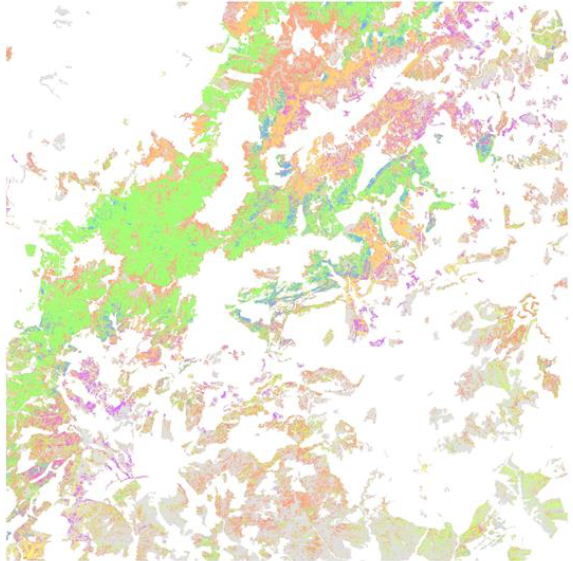
Design of an Automatic Algorithm for Land Use Mapping and Change Detection Based on Satellite Images
Author: Diego Madruga Ramos.
Supervisors: Consuelo Gonzalo Martín and Alicia Palacios Orueta
2024. Bachelor’s thesis

Drought Assessment in Ecuador Using the SPEI Index and Spectral Indices for the Period 2000–2022.
Author: Javier Coronel Burneo.
Supervisors: Alicia Palacios Orueta and César Sáenz Flores.
2024. Master’s thesis.

Analysis of the regeneration of vegetation cover after the Riba de Saelices Forest Fire (Guadalajara, Spain 2005) using Remote Sensing Time Series.
Author: Ignacio Ruiz de la Peña Barreda
Supervisors: Silvia Merino de Miguel
2023. Bachelor’s tesis

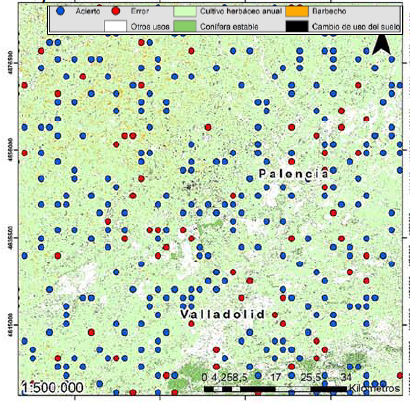
Analysis of Land Use and Land Cover changes in the La Jara Region and the National Park of Cabañeros using Landsat images during the period 1985 – 2022.
Author: Daniel Heredia Bernardo
Supervisors: Sergio González Ávila & Silvia Merino de Miguel
2023. Bachelor’s tesis

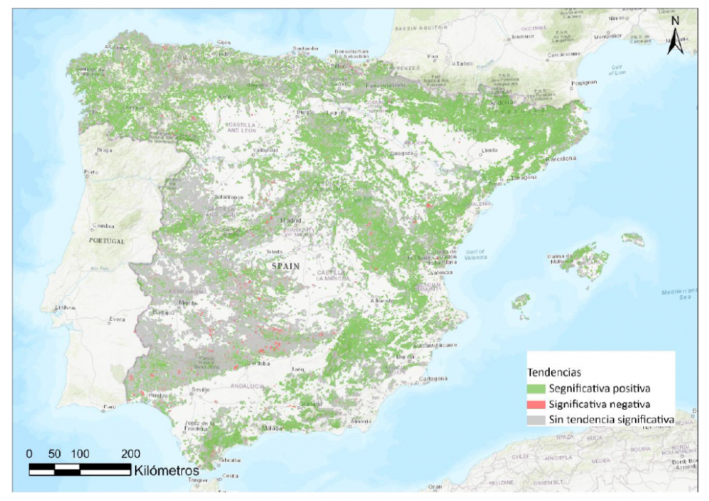
Evolution of drought in mainland Spain using satellite images during the period 2000-2022
Author: Aurora López del Cisne
Supervisors: Silvia Merino de Miguel and César Sáenz Flores
2023. Bachelor’s thesis

Delimitation of illegally irrigated crop areas in the catchment area of the Mar Menor (Murcia), between 2019 and 2022 using remote sensing techniques.
Author: Diego Celdrán Rubio
Supervisors: Silvia Merino de Miguel
2022. Bachelor’s tesis

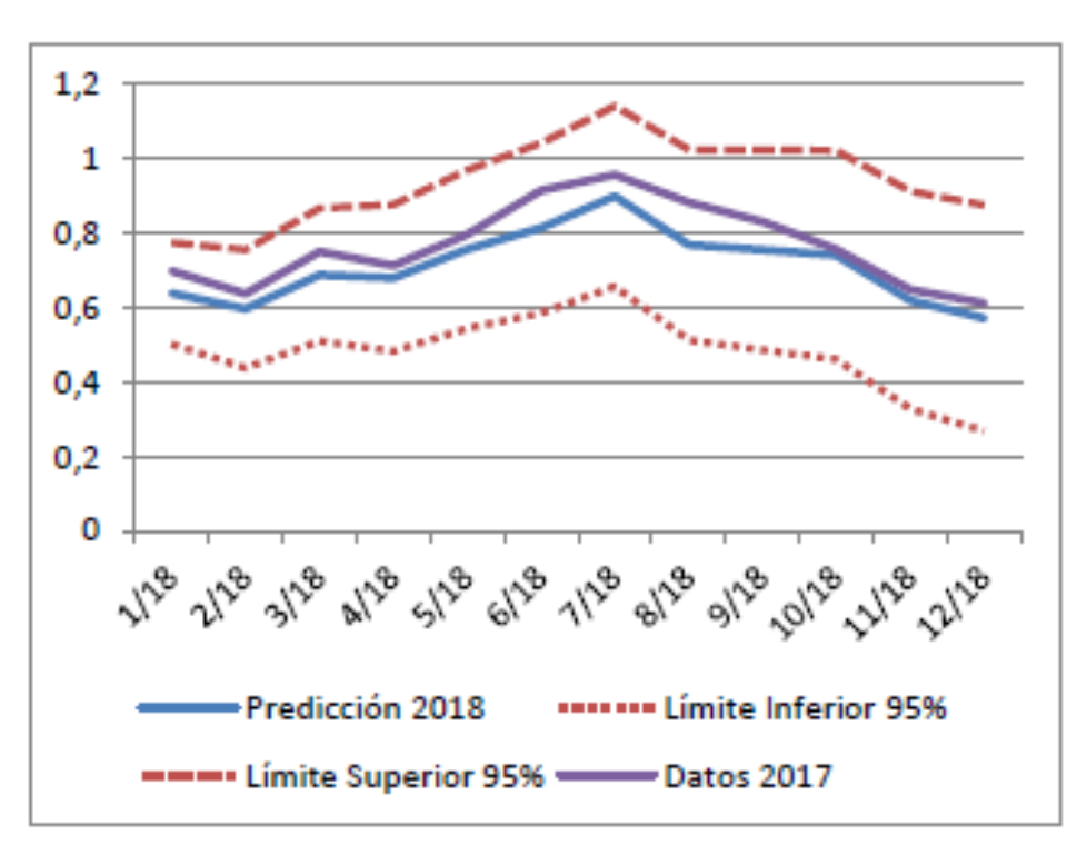
Statistical analysis of climatology and vegetation dynamics in a region along the Duero riverbank.
Author: Alfonso Bermejo Saiz
Supervisors: Jesús Javier Litago Lavilla and César Sáenz Flores
2022. Master’s thesis
Assessment of forest as carbon sinkes or emitters through remote sensing time series analysis. Application to mainland Spain and Balearic Islands.
Author: Cristina Sánchez-Cabezudo Goytre.
Supervisors: Silvia Merino de Miguel and Laura Recuero Pavón.
2022. Bachelor’s thesis.

Development of a GIS tool for the implementation of Sustainable Urban Drainage Systems in cities. Application in the municipality of Gavà (Barcelona).
Author: Carlota Buznego Puerto
Supervisors: Silvia Merino de Miguel and Sara Perales Momparler
2021. Bachelor’s tesis

Evaluation of the August 2019 Gran Canaria Forest Fire using Sentinel-2 images.
Author: Marta Arencibia Fontes
Supervisors: Silvia Merino de Miguel
2020.Bachelor’s tesis
Climate factors affecting variability performance in the vineyards of CV. Albariño in the Rías Baixas designation of origin.
Author: Carmen Fernández Uriarte.
Supervisors: Jesús Javier Litago Lavilla and Pedro Junquera González.
2020. Master’s thesis.
Author: Miguel Moncada Isla.
Supervisors: Silvia Merino de Miguel and Laura Recuero Pavón.
2020. Master’s thesis.
Mapping of tree covers based on the Spanish Forest Map using Sentinel-2 time series. Application to an area in the Guadarrama Mountains.
Author: Laura Kornberger Rodríguez.
Supervisors: Alicia Palacios Orueta and Laura Recuero Pavón.
2020. Bachelor’s thesis.
Assessment of Sentinel-2 NDVI time series to study land use in agricultural and forest areas.
Author: Fátima Arrogante Funes.
Supervisors: Alicia Palacios Orueta and Laura Recuero Pavón.
2019. Bachelor’s thesis.
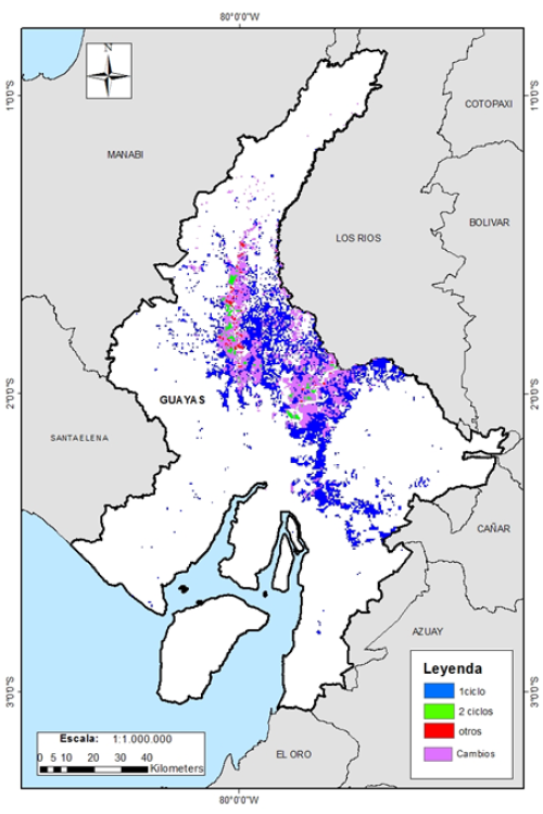
Mapping rice cultivation in Guayas (Ecuador) using time series of high spatial resolution images Sentinel-2.
Author: Javier Jose Dávalos Barquet.
Supervisors: Alicia Palacios Orueta and Jesús Javier Litago Lavilla.
2019. Master’s thesis.
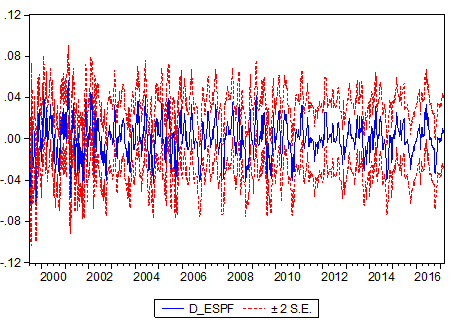
Econometric models and of prediction of the alimentary consumption in the
Spanish homes”.
Author: Pablo Andrés Martín Grande.
Supervisors: Jesús Javier Litago Lavilla.
2018. Master’s thesis.
Definition of a predictive model to analyze the
evolution of pork prices and its
relationship with quality parameters in the raw material, food and market trends.
Author: Sylvia Dávila Uricoechea.
Supervisors: María del Carmen González Chamorro, Ana Isabel García Hermosilla and Jesús Javier Litago Lavilla.
2017. Master’s thesis.
Cartography of the dynamics and intensification of hard yellow rice and corn crops in Guayas and Los Ríos – Ecuador, through NDVI Time Series Analysis derived from MODIS sensor images.
Author: Lilian Maricela Maila Chiguano.
Supervisors: Alicia Palacios Orueta.
2016. Master’s thesis.
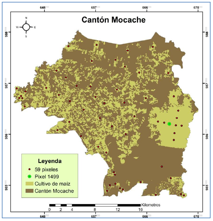
Study of corn crops dynamics (Zea mays, L.) from NDVI vegetation index time series registered by the MODIS sensor in the Mocache canton (Ecuador)
Author: César Sáenz Flores.
Supervisors: Alicia Palacios Orueta and Jesús Javier Litago Lavilla.
2015. Master’s thesis.
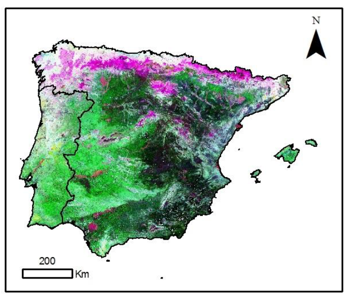
Evaluating the response of vegetation index NDVI to precipitation variations in mainland Spain and the Balearic Islands in 2000-2010.
Author: Laura Recuero Pavón.
Supervisors: Alicia Palacios Orueta and Margarita Huesca Martínez.
2013. Bachelor’s thesis.
Analysis of fire seasonality in Navarra through remote sensing.
Author: María Quirós Segovia.
Supervisors: Alicia Palacios Orueta and Margarita Huesca Martínez.
2012. Bachelor’s thesis.
Evaluation and modeling of the dynamics of Production of Mediterranean agroforestry ecosystems through the statistical analysis of remote sensing images of time series from the MODIS sensor. Relationship with variables
meteorological.
Author: Victor Cicuéndez López-Ocaña.
Supervisors: Alicia Palacios Orueta and Jesús Javier Litago Lavilla.
2012. Master’s thesis.