INFOLANDYN project
An information system to monitor global change impacts: modeling land cover dynamics based on high added value indicators
Period: September 2021-August 2024
Project PID2020-115509RB-I00 funded by MCIN/AEI/ 10.13039/501100011033 (Call 2020 – « I+D+i Projects»)
Satellite Data
Stadistical Products
Indicators
Environmental Statistics
Papers & Reports
All of our products are uploaded to the product catalog page to be downloaded completly for free by anyone.
In the current context of global change, a wide and deep knowledge on land surface dynamics at large scales is crucial to understand biosphere-atmosphere interactions, to make climate predictions and to manage natural resources and agricultural lands helping to ensure food security.
The aim of this project is to design and implement an Information System to develop and make available objective, succinct and clear products of land surface dynamics derived from remote sensing time series at several scales. The products developed will contain ecological meaning providing essential information to assess global change impacts. These products will be easily revised and updated so that operability will be guaranteed.
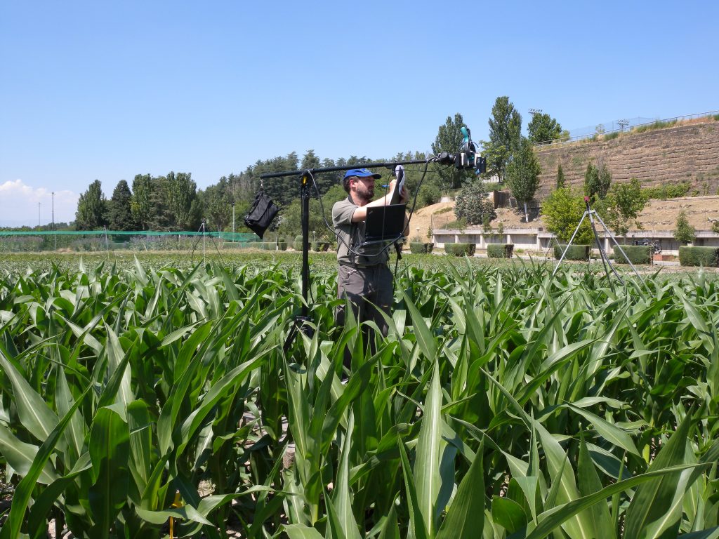
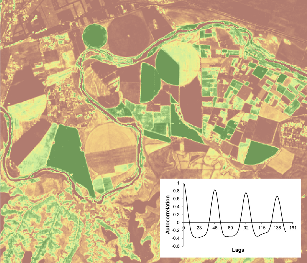
The type of products proposed includes phenological and dynamics indicators such as: (1) vegetation intra-annual dynamics defined by phenological cycles, (2) type and persistence of inter-annual patterns (3) presence of trends in the vegetation indexes time series, (4) presence of structural changes, (5) forecasting models, (6) onset, end, and length of growing season (7) dynamics assessment based on phenological metrics and (8) indicators related to climate impacts.
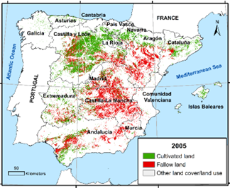
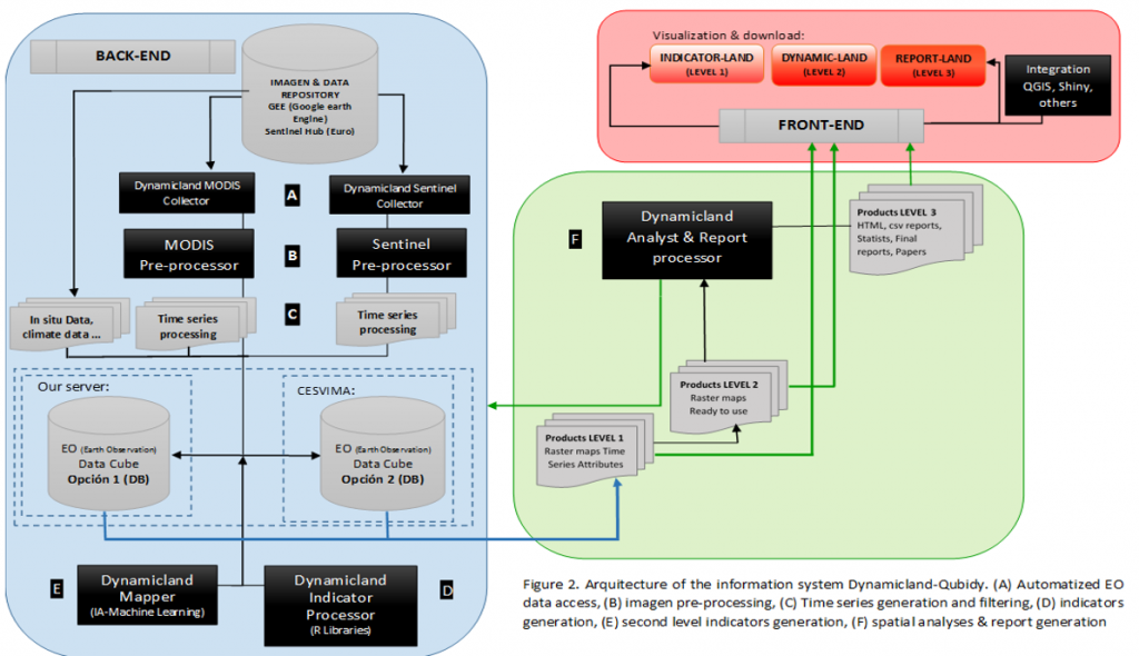
Cartographic products at two levels will be developed: (1) first level will consist of products representing the general attributes of vegetation index time series based on statistical and phenological methods, such as inflection points or autocorrelation values at specific lags, (2) in a second level the “Ready to Use” products will consist on environmental information related to the processes happening at the land surface, such as maps of the beginning of the growing cycles or the date of harvest. In addition, analysis and reports will be generated.
For more information about the INFOLANDYN project, visit the INFOLANDYN page.