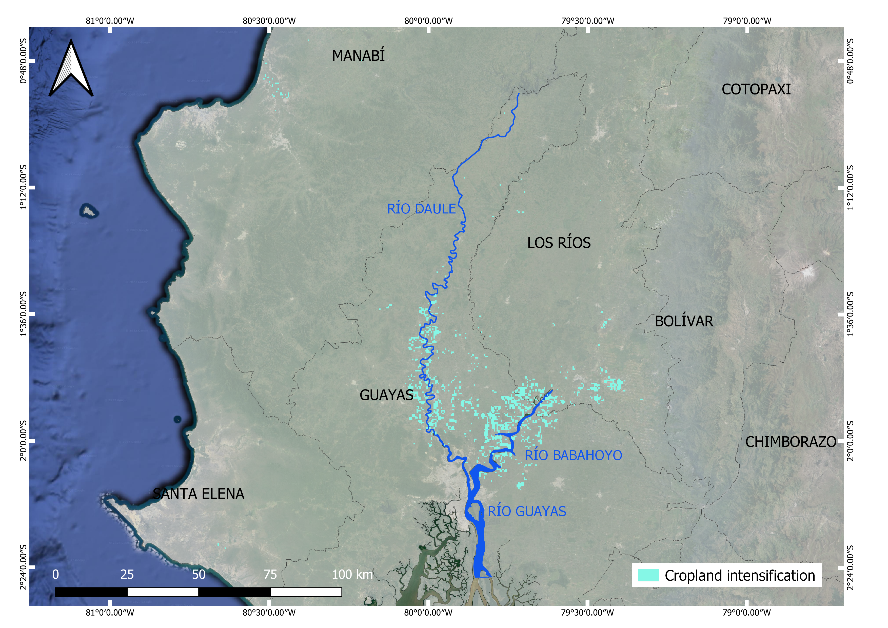
Multiple cropping —growing more than one crop in the same field each year—is a crucial agricultural practice to ensure food supplies in response to the rising demand for staple cereals driven by global population growth and the impacts of climate change. In this context, it is essential to develop new methodologies for accurately monitoring cropland intensification. In this regard, we proposed a novel methodology based on the spectral analysis of remotes sensing time series to assess cropland intensification in Ecuador, a tropical region where cloud cover complicates crop monitoring. Using 20-year series of NDVI (Normalized Difference Vegetation Index) data from 2001 to 2020, we analyzed differences in the number of crop cycles in major rice and maize areas, identifying fields with one, two, or three crop cycles per year across four subperiods. This approach allowed us to monitor changes in cropping systems over time and detect shifts toward more intensive agriculture.
The findings revealed that over 50% of the studied croplands changed its cropping practices, with 40% of the land showing an increase in the number of crop cycles. This trend was particularly noticeable near rivers, where irrigation supports crop growth during dry periods. These results underscore the potential of spectral analysis to track agricultural intensification in challenging, cloudy tropical regions.
Results were published in Recuero et al., 2023.

