Hello to everybody!
Last monday 25th April we started the day with Andrés Iriso from Dirección General de Salud Pública de la Consejería de Sanidad (Comunidad de Madrid). He showed us different methodologies to visualise on maps health data on epidemiology studies.
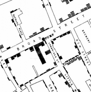
First cases of public health georreferenced studies are the ones from doctor Snow in 1854 in London, to identify the origin of different cholera epidemics.
Nowadays, the main challenge is to obtain the precise data with the specific location, moreover with the data protection policies that make it very restrictive to get any data addressing health issues. There are several techniques to analyse this data from health indicators and it is important to know to read the data, as one single value can alter the proportion and rates if we are working with low densities references.
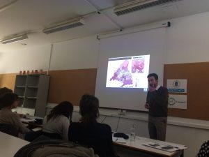
Andrés Iriso showing different study cases he had developed in his research group.
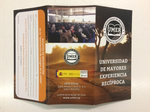
After the break, Fidel Revilla, president from Universidad de Mayores Experiencia Recíproca (UMER) explained to us the “Madrid Age-Friendly City Plan” from the point of view of the elderly who had contributed and participated in its first diagnosis part.
Some of the identified problems in the first diagnosis document of this strategic plan were not taken into high priority consideration in the action plan document.
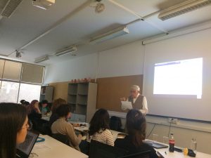
Fidel Revilla explaining the main intervention axes of the Age-Friendly City Plan.
The main idea that Fidel defended was to be aware of the importance of making the elderly active part of all the participation process and projects that are happening in the city.
Next week we will finish our seminar program with a presentation led by ESRI and then, the visit to the ARUP laboratory! We are looking forward to meet you all there!
UNI-Healh Team