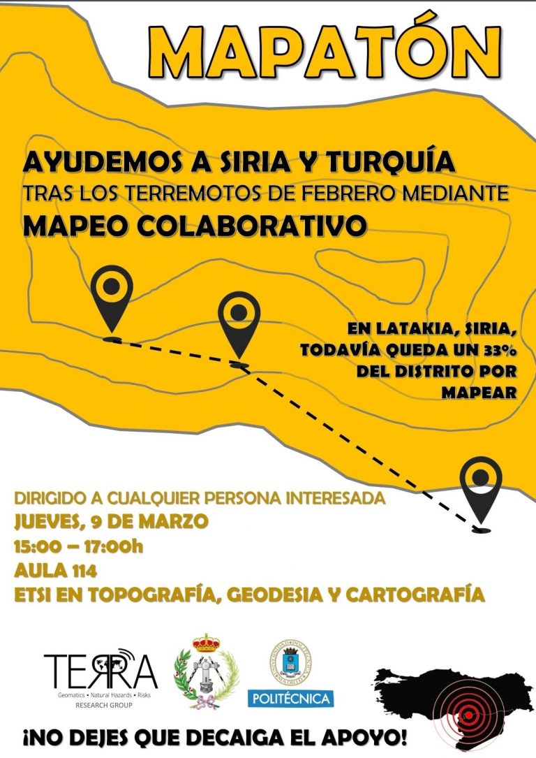
MAPATÓN de ayuda a Siria y Turquía el 9 de marzo.
Ya están abiertos los registros presenciales y online.
¡Apúntate para poder realizar correctamente el mapeo colaborativo!
Categoría: Técnicas geomáticas
Active faults of El Salvador
In this work we present a review of the current state of knowledge of the active faults in El Salvador and its seismo-tectonic implications. An updated map of active fault traces is combined with the spatial analysis of shallow seismicity, focal mechanisms, recent geodetic GPS velocities, local strain estimations and morpho-tectonic features to provide a synoptic view of the active tectonics of the El Salvador.
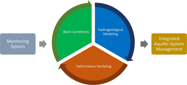
Improving multi-technique monitoring using Sentinel-1 and Cosmo-SkyMed data and upgrading groundwater model capabilities
Aquifer-systems have become a strategic source of fresh water in the present climatic conditions, especially under stress in arid regions like the Iberian Mediterranean Arc. Understanding the behavior of groundwater reservoirs is crucial to their well-management and mitigation of adverse consequences of overexploitation.
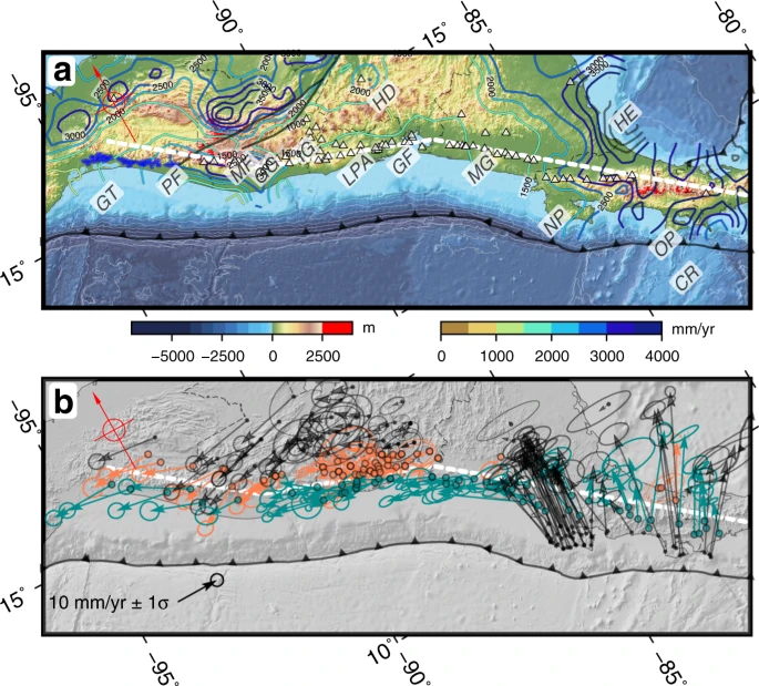
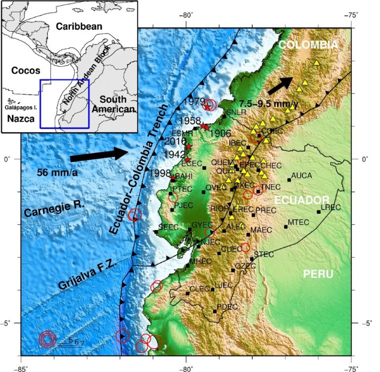
Crustal motion and deformation in Ecuador from GNSS Time Series
In this paper, we present the first velocity field from cGNSS (continuous GNSS) stations in the Continuous Monitoring GNSS Network (REGME) in Ecuador. We have analyzed data from 33 cGNSS REGME stations for the 2008–2014 period in order to characterize horizontal crustal motion and deformation in Ecuador.
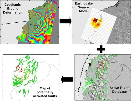
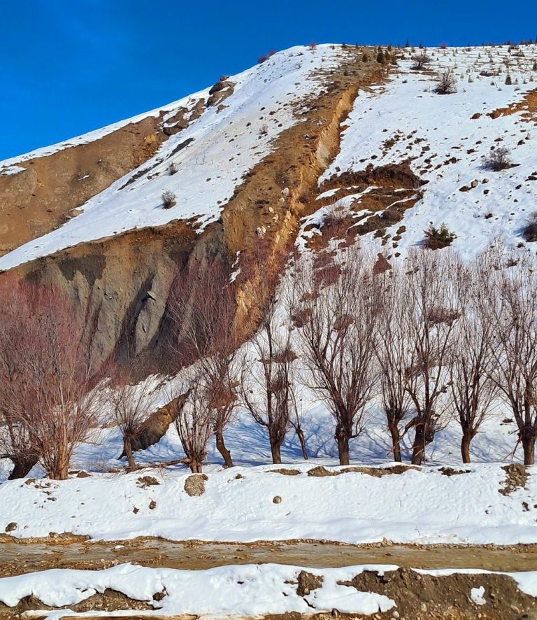
InSAR-Based Mapping to Support Decision-Making after an Earthquake
It has long been recognized that earthquakes change the stress in the upper crust around the fault rupture and can influence the behaviour of neighbouring faults and volcanoes. Rapid estimates of these stress changes can provide the authorities managing the post-disaster situation with valuable data to identify and monitor potential threads and to update the estimates of seismic and volcanic hazard in a region.
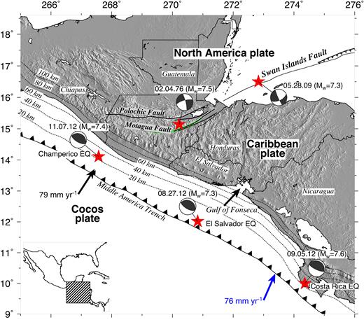
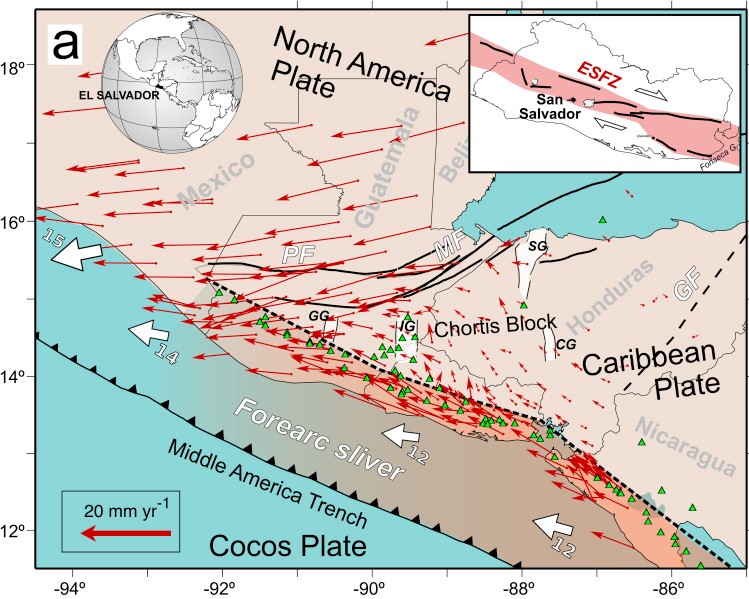
GPS constraints on deformation in northern Central America from 1999 to 2017, Part 1 – Time-dependent modelling of large regional earthquakes and their post-seismic effects.
We use continuous and campaign measurements from 215 GPS sites in northern Central America and southern Mexico to estimate coseismic and afterslip solutions for the 2009 Mw = 7.3 Swan Islands fault strike-slip earthquake and the 2012 Mw = 7.3 El Salvador and Mw = 7.4 Guatemala thrust-faulting earthquakes on the Middle America trench.