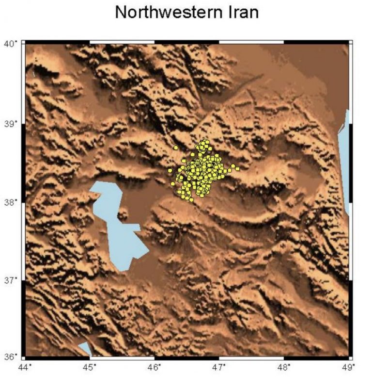
On 11 August 2012, two destructive shallow earthquakes Mw=6.4 and
Mw=6.2 occurred within distance of about 6 km and time lag of 11
minutes in Northwestern Iran between the small cities of Ahar and
Varzeghan with no previously well known active fault or significant
seismicity.
Autor: miguelgarridocorral
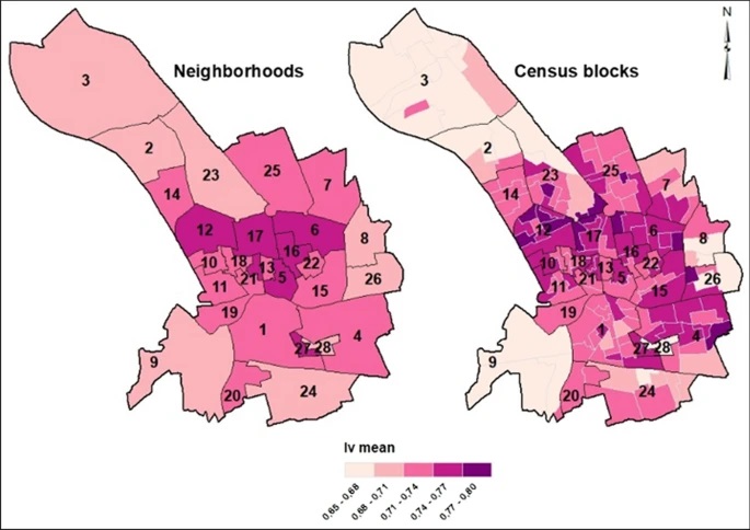
Classifying buildings according to seismic vulnerability using Cluster-ANN techniques: application to the city of Murcia, Spain
The seismic vulnerability of a city is a degree of its intrinsic susceptibility or predisposition to sustain damage or losses stemming from seismic events. In terms of physical vulnerability, one of the most important factors for assessing seismic risk, especially, for estimating losses, is the exposure of structures, particularly those structures intended for residential use.
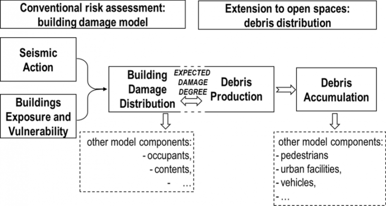
Extending urban seismic risk assessment to open spaces for the 2011 Lorca earthquake scenario
We extend the conventional seismic risk assessment approach to open spaces in the 2011 Lorca earthquake scenario. Conventional approaches to seismic risk provide estimates of damaged buildings mainly related to structural failure. The damage related to the production of debris in damaged buildings and its spread in the surrounding space receives a secondary role. However, in many cases, this secondary damage is of prime importance.
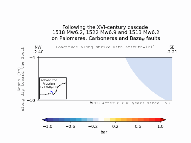
Coulomb stress transfer as an explanation for a XVI-century earthquake cascade in the Eastern Betics Cordillera, Spain; Insights from viscoelastic relaxation of the lithosphere and postseismic stress triggering.
The Eastern Betics Cordillera embraces a zone of low-to-moderate seismic activity located at the SE of the Iberian Peninsula. However, a major active fault system which crosses the area, ca. 500 km long, known as the Eastern Betics Shear Zone (EBSZ), has been responsible for the occurrence of several large historical earthquakes (Mw> 6.0) since the beginning of the historical record. Finding physics-based evidence for relations between significant historical events in such a moderate-slipping fault system would help us narrate them as long-term cascades.
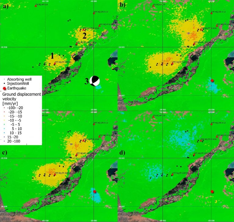
Assessment of ground deformation and seismicity in two areas of intense hydrocarbon production in the Argentinian Patagonia
The exploitation of both conventional and unconventional hydrocarbons may lead to still not well-known environmental consequences such as ground deformation and induced/triggered seismicity. Identifying and characterizing these effects is fundamental for prevention or mitigation purposes, especially when they impact populated areas.